 Best Seller
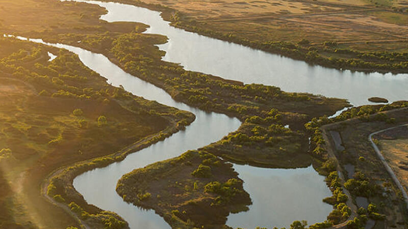
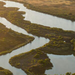


You probably won’t find a better fishing destination than the San Joaquin River region. With hundreds of miles of waterways and almost 200 islands, the Sacramento San Joaquin Delta region has some of the finest fishing waters in California.
This California region offers excellent year-round fishing opportunities, but it can be challenging for beginners. Looking for fish in the maze of rivers and channels may be demanding, but it is also an exciting experience. If you are looking for the best spots, consider some of the following suggestions.
 The Delta lies around the confluence of the Sacramento River and San Joaquin River, where they meet the small tributaries. Once the waters meet, they flow into San Francisco Bay and continue to the Pacific.
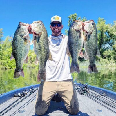
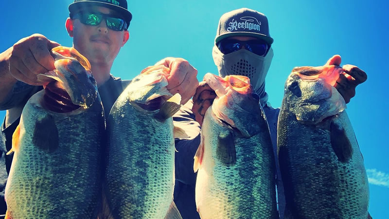
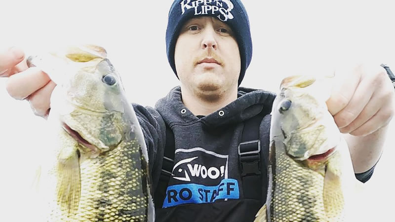
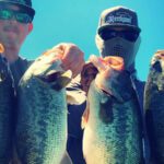
You may find several popular fish species in this area. Sturgeon and catfish tend to swim in the deep. Smallmouth, largemouth, and spotted bass thrive in this region. The stripers and salmon that run here each year are the most popular fish species.
Visitors can look into the San Joaquin’s North Fork, a widespread habitat for wild rainbow trout in the middle and lower sections of the river. Moving further up the smallest fork of the San Joaquin River, there is a higher presence of brook trout. Golden trout can be found in some of the surrounding lakes.
The main river fork is not fishable after September due to high flows. It is a favorite spot for those just starting with fly fishing. Don’t be surprised by the fish size if you settle around the Mammoth pool reservoir, which has seen some rather large fish.
The San Joaquin South Fork’s fishing season starts last Saturday in April and continues until November. While spring is not an optimal time for fishing, summer and fall are the best seasons to throw bait.
Choose one of the cherished spots in the San Joaquin Valley and enjoy. To ensure you comply with California fishing regulations, check with local authorities for any updates.
This 65-mile water body begins in the Sierra Nevada and concludes in the eastern part of California’s Central Valley. It consists of three forks – the Middle being the most significant tributary – and joins the confluence with the North Fork in the west. The South Fork is smaller and descends to the east of the Sierra Nevada.
The total length of the Stanislaus River is about 150 miles, passing through heavily forested terrain. It joins the San Joaquin River Ca south of Manteca, northeast of Vernalis, and 75 miles upstream at Suisun Bay. The river reaches the sixth-tallest US dam, New Melones Dam, and the oldest dam on the river, Goodwin Dam.
The Stanislaus River is an essential resource for California in the Sacramento San Joaquin Delta, used to recharge groundwater, dilute pollution, and maintain fisheries. Over 36 fish species live in the river, including salmon, rainbow trout, hardhead, Pacific lamprey, sunfish, and bass.
The chinook salmon and steelhead are at home in the waters of the Stanislaus River, or at least they were. Being the most heavily dammed river today, it was previously the central spot for spring-run chinook salmon and occasional fall-run chinook salmon. Today, chinook salmon and steelhead populations have significantly declined due to water diversions and irrigation.
Whitewater boating is one of the most popular activities on the river, along with flat-water boating and swimming. For those who enjoy rafting, the water flows are more suitable in the summer, while spring flows are generally high. Other recreational activities include backpacking, camping, kayaking, fishing, and hiking.
Why not spend the winter days snowmobiling or go horseback riding once the weather turns warmer? The Stanislaus National Forest is available to the public for unrestricted use. Many reservoirs along the river offer boating and water skiing, or if you wish to try fishing, they offer fishing gear for novice anglers.
Be sure to learn more about the fishing regulations before going on your next fishing trip to avoid any possible fines.
 Tulare Lake, part of an endorheic basin, got its name from the tule rush in this area. Homeland to the Tachi tribe until the American and Spanish colonists took over the lands; it used to be a biodiverse area.
Building reed boats and hunting antelopes, deer, and elk were the main activities of the Yokuts people. Being the largest freshwater wetland back in the day, they used Tulare Lake for fishing. Besides supporting a vital fishery, Tulare Lake is a source of western pond turtles.
An ecological disaster struck in the 19th century when the settlers drained the marshes for agricultural and irrigation purposes. The area faced a substantial loss of habitats for aquatic animals, migrating and local birds, and plants. The lake entered the 20th century almost dry.
Today, the basin is the most productive agricultural region within the Central Valley. It is a network of vineyards, agricultural fields, and orange groves coexisting with oil and gas extraction fields. Cotton, corn, and grains are the main crops found in the basin.
If you find yourself in the Tulare basin area, you can enjoy golfing, spend a day at one of the local parks, or feast on a delicious meal. Take a trip to the Sequoia National Park and go hiking, cycling, and fishing among the giant sequoia trees.
At an elevation of 7,880 feet east of Mammoth Mountain, you will find the town of Mammoth Lakes. This place in Mono County is known for the Mono people, the first settlers of the valley. They were considered good traders who traveled on foot between villages to trade with other tribes.
Part of its unsuccessful European history includes mining Mineral Hill, which created a gold rush in 1878. Three years later, the closing of the mining camp reduced the population to only a few people.
Summertime in the mountains can be as fun as spending it by the sea. Today, Mammoth Lakes offers year-round adventures for everyone. Visitors can explore the area by mountain biking, taking a pleasant hike, or camping in the wilderness. You can also use the opportunity to transfer your love for fly fishing on scenic lakes and streams.
Fall may be when nature prepares for the long winter months, but the visitors don’t have to. This is the best time for horseback riding, hiking, and mountain biking.
For all skiing fans, Mammoth Mountain offers its famous terrain for snowboarding, snowshoeing, skiing, and cross-country skiing. But the winter days offer so much more than just skiing. Visitors can enjoy winter activities such as snowball fights and sledding.
Spring has to be the most exciting time in Mammoth Lakes, offering a mix of winter and summer activities. Visitors may hit the slopes in the morning and enjoy kayaking or fishing on the lake in the afternoon.
Cradled at the confluence of the San Joaquin River and Sacramento River, this estuary is an extension of the San Francisco Bay. Named after the Suisunes, a Wintun Indian tribe, the bay forms the entrance of the Sacramento San Joaquin Delta.
Those involved in preserving the ecosystem in the area know that the bay was where the Mothball Fleet or Ghost Fleet lay. This collection of military ships presented an ecological disaster for San Francisco Bay. They were supposedly saved from being reactivated if needed, but were decaying and polluting the area.
Luckily, ecological activists didn’t sit still. They did everything in their power and succeeded in getting the fleet removed and saving the wildlife that still exists in the bay.
It is a habitat for many endangered fish, including the Delta smelt and chinook salmon. Many native bird species also exist here, and many migrating birds use this place as a feeding stop each year.
Suisun is also a favorite fishing spot for anglers because it is close to Bay Point. White sturgeon, rainbow trout, walleye, largemouth, and striped bass are popular fish species in these waters. If you decide on a fishing trip in this area, follow local fishing regulations to avoid trouble.
 Going past the Mammoth Lakes, you’ll reach the Middle Fork of the San Joaquin River Ca. It starts at Thousand Island Lakes and merges with the Sacramento River in the Sacramento San Joaquin Delta.
Flowing through the Reds Meadow, Middle Fork offers superb fishing. Anglers prefer the easily accessible Eastern Sierra areas popular for fly fishing and bait fishing along the river.
The fish population in this area, including browns, rainbows, and brook trout, is relatively dense.
The stretch below Minaret Falls is one of the most popular fishing spots, followed by Devil’s Postpile. You can also enjoy a short hike and fishing at Rainbow Falls, near the Reds Meadow’s southern end.
The upper section of the fork inhabits the golden trout, which has mated with the rainbow trout, a resident in these waters. You can find the rainbow and golden trout in the faster waters of the middle section, while the brown and brook trout enjoy the slower flows.
Settled by the Paiute and Miwok people, the California Gold Rush fever was why many settled along the Merced River. With headwaters at the Clark Range, the Mercer River continues its journey through the scenic Yosemite National Park. Flowing through the Sierra Nevada, it is the San Joaquin River’s 145-mile-long tributary.
Spread over 1,726 miles, the Mercer River basin’s high elevation results from the heavy snowfalls melting in spring and summer. This is not the case in autumn when some tributaries dry up.
Around 37 fish species, 140 insects, and nearly 127 bird species exist along the third-largest tributary of the San Joaquin River, California. Of the 37 fish species, 27 are native species, and the remaining are present in the lower section of the Merced River. Some fish species include the carp, smallmouth and largemouth bass, and the Sacramento sucker. The list will not be complete without the striped bass and chinook salmon.
The Merced Canyon is the only habitat for the extremely rare limestone salamander. The rich flora and fauna along the Merced River include California poppy, poison oak, sugar pine, beavers, mule deer, coyotes, black bears, and much more. Because the salamander depends on the Merced Canyon limestone walls for survival, a 20-mile stretch was designated a critical area.
Being part of Yosemite National Park, the Merced River is a thriving recreational area. Boating on Lake McClure, camping in permitted campgrounds along the river, hiking on picturesque trails, or going on a fishing adventure are just some of the options.
Central California is known for abundant water bodies providing habitat to diverse wildlife and fish populations. Starting in the Sierra Nevada, the 366-mile San Joaquin River is the longest river to flow through the rich agricultural region.
The San Joaquin River in CA offers rich wildlife viewing, excellent fishing spots, and the best recreational opportunities for visitors. It flows northwest to join the Sacramento River and has many national wildlife refuges in its wetlands.
In this article, we’ll explore the San Joaquin River and its thriving fauna and go over the history of this magnificent reservoir.
 The San Joaquin River watershed is California’s largest single river basin, spanning 31,000 square miles. Stretching from Bakersfield to Lodi, the San Joaquin Valley covers 17 counties and runs parallel with the Pacific Coast. The highest headwaters are at 12,000 feet; at the Sierra Nevada foothills, they can reach 580 feet above sea level.
The river carried several names throughout history. Rio de San Francisco, Rio San Juan Bautista, and Great River are some names used for the Joaquin River. Native Americans referred to it as Peticutry, the official name in the USGS.
Ansel Adams Wilderness is where the San Joaquin River begins its watery journey. More precisely, it all starts in the south-central Sierra Nevada, where the major affluents Middle Fork, North Fork, and South Fork meet. The Middle Fork is considered the largest of the affluents.
From the alpine headwaters, the San Joaquin River flows into the Sierra Nevada foothills and emerges at Friant Dam. Flowing southwest to the San Joaquin Valley, or the Great Central Valley, it continues its journey north of Fresno.
The Tuolumne, Stanislaus, and Merced rivers, the three major tributaries of the San Joaquin River, serve almost exclusively for agricultural use. The Mokelumne River and Calaveras River are also among the tributaries of the San Joaquin River.
San Francisco and other surrounding areas are supplied with drinking water while declining, and endangered species find refuge in the San Joaquin River.
To see a complete list of great California Fishing Guides, please click here!
Back in the day, steamboats navigated the San Joaquin watershed. They went all the way to Fresno, but agricultural development put a stop to this. With irrigation development in the Sierra Nevada and countless water diversions along tributaries diverting a significant portion of the natural flow, the surrounding communities faced frequent droughts.
Groundwater pumping became standard after the surface waters proved insufficient due to the increased agricultural development. Groundwater withdrawal accounted for a significant portion of the water pumped in the Central Valley, exceeding the flow of the San Joaquin River, CA, by more than twice.
The river has many tributaries that feed the whole system and relieve the pressure added to the river due to the drought-prone places. The California State Water Resources Control Board must always be on the lookout and have a plan to manage the river and the principal tributaries.
Plans should include maintaining the natural flow regime, protecting water quality, and safeguarding endangered species such as chinook salmon.
Fish like the chinook salmon and the steelhead trout thrived for centuries in these rivers. As water diversions increased, selected portions of the San Joaquin mainstream were left dry.
This led to the chinook salmon and the steelhead trout being on the verge of extinction. In 2008 and 2009, the commercial salmon fishery was closed entirely to protect at least some of the remaining chinook salmon.
Historic fish-processing industries have closed their doors and are now used to inspire ocean conservation. Given that the Sacramento-San Joaquin Delta provides drinking water to millions of Californians, poor water quality is not an option. Authorities are working on restoring the flow of the San Joaquin River and the habitats of the endangered fish species.
The San Joaquin River in California is where Pacific and Chinook salmon make their runs. The tributaries were where the Pacific Salmon’s third-largest run occurred. It is also the place of the late fall run of chinook salmon. The beginning of the 20th century marked as high as 500,000 annual spawners, but this changed very soon.
Building the major dams in the San Joaquin watershed cut off the salmon runs. The Friant Dam is said to have interrupted a 6,000-mile streambed suitable for spawning salmon. The installation of barriers blocked the gravel from naturally passing downstream.
Redd construction is when the salmon forms a nest and moves smaller pieces of gravel to bury the eggs. Due to the barriers and the small number of suitable spawning beds, the salmon had to lay eggs on top of existing reeds. Combine this with the rising temperatures unsuitable for the chinook salmon, and the egg morbidity and abnormalities are frightening.
Predators such as bass and bluegill are also contributing to the decline of the salmon population. The California Department of Fish and Game is working with the California Department of Water Resources to keep fish in the main channel of the San Joaquin River, Ca.
In short, changes in stream flow, damming rivers, water diversions, and poor water quality have proven to be harmful to fish. It impacts their survival and reduces the available habitats and access to spawning locations.
The government developed a long-term restoration program for the San Joaquin River to preserve the endangered chinook salmon population and avoid the negative impacts on the water supply. This program includes restoring flows in the San Joaquin River from the Friant Dam to the confluence with the Merced River.
Construction of the Friant Dam disrupted the spawning runs. The lower San Joaquin River and its tributaries still support the fall-run chinook salmon because of the clean and cool waters. The federal agencies were authorized to implement the Settlement Act to restore the salmon runs.
The San Joaquin River Ca area offers plenty of outdoor activities for all ages and interests, such as fishing, hiking, and mountain biking. You can also enjoy a day in one of the museums, picnic in the picturesque parks, or spend a day on one of the many golf courses.
In the days when the Miwok and Yokuts tribes inhabited the region, the San Joaquin River was known for its frequent flooding and for creating many valley lakes. The Yokuts tribe mainly occupied the San Joaquin basin, but other indigenous peoples, such as the Chumash and Paiute, also lived in these lands.
Before the arrival of the Europeans, the people in the San Joaquin area lived in tribes. Although many nomadic people traversed the land of abundance, some tribes rarely traveled beyond their neighboring village. The village camps had no more than several hundred inhabitants.
The local people were excellent hunters and explored the rich vegetation using their gathering capabilities. One of the primary food sources was the acorn, crushed by acorn mills, and one can still find it in the area of the Kaweah River.
Don Pedro Fages and Father Juan Crespi were the first Europeans to arrive in this region in 1772. Fages explored the southern part of the San Joaquin Valley, which was unexplored until the arrival of Gabriel Moraga.
Moraga and his group explored the area, naming many of the places they passed. It was Moraga who christened the San Joaquin River after St. Joachim, and he was also the godfather of the Merced River.
The arrival of the Spanish colonists was well received by the local population at first. However, as time passed, what had started as a friendly relationship turned into hostility and riots.
Natives would take the horses and cattle for food, and the Spanish would, in turn, burn the villages and camps. This behavior led to continuous violence and a huge cultural gap, distancing the people further.
Big Creek Hydroelectric Project is one of the most extensive systems in the world. The whole project includes eight dams, tunnels, and nine powerhouses. Henry E. Huntington and John S. Eastwood were the brilliant minds behind the construction of the San Joaquin River.
With the increased demands for electricity in the region, the railroad baron and the engineer would turn to the San Joaquin River. Establishing a power company, Huntington and Eastwood bought the water rights of the upper San Joaquin River. Construction began in 1911, and the system was built in stages throughout the 20th century.
The system, nicknamed “the hardest working water in the world,” uses and reuses water from the San Joaquin River over a 6,200-foot drop. Redinger and Mammoth Pool Dams are just a few of the powerhouses’ facilities, with a total installed capacity of 1,014 MW.
Friant Dam is the main dam completed in 1942. Its primary purpose is to divert water into the Madera and Friant-Kern Canals, but it also serves for flood control and irrigation storage. The Friant Dam reservoir, Millerton Lake, is small when compared to Pine Flat and Don Pedro reservoirs in the San Joaquin basin.
The San Joaquin Valley is a maze of rivers that offer a variety of opportunities to spend a lovely weekend outdoors—an area with a deep historical significance and turbulent past. Many indigenous tribes have called it home. Rich in water resources and offering extensive opportunities for fishing, gathering, and hunting for food, the native people’s lives were disrupted by numerous colonists.
Agricultural and irrigation development along the San Joaquin River in Northern California brought about changes. Some sacrifices had to be made for the region’s growth.
Today, the San Joaquin Basin in California is a popular recreational destination for everyone. Hiking, camping, boating, and swimming are just some of the outdoor activities that you may enjoy at one of the many locations. Local authorities are taking precautionary measures to restore the spring-run chinook salmon and preserve the habitat of the striped bass, grass carp, and other fish species.