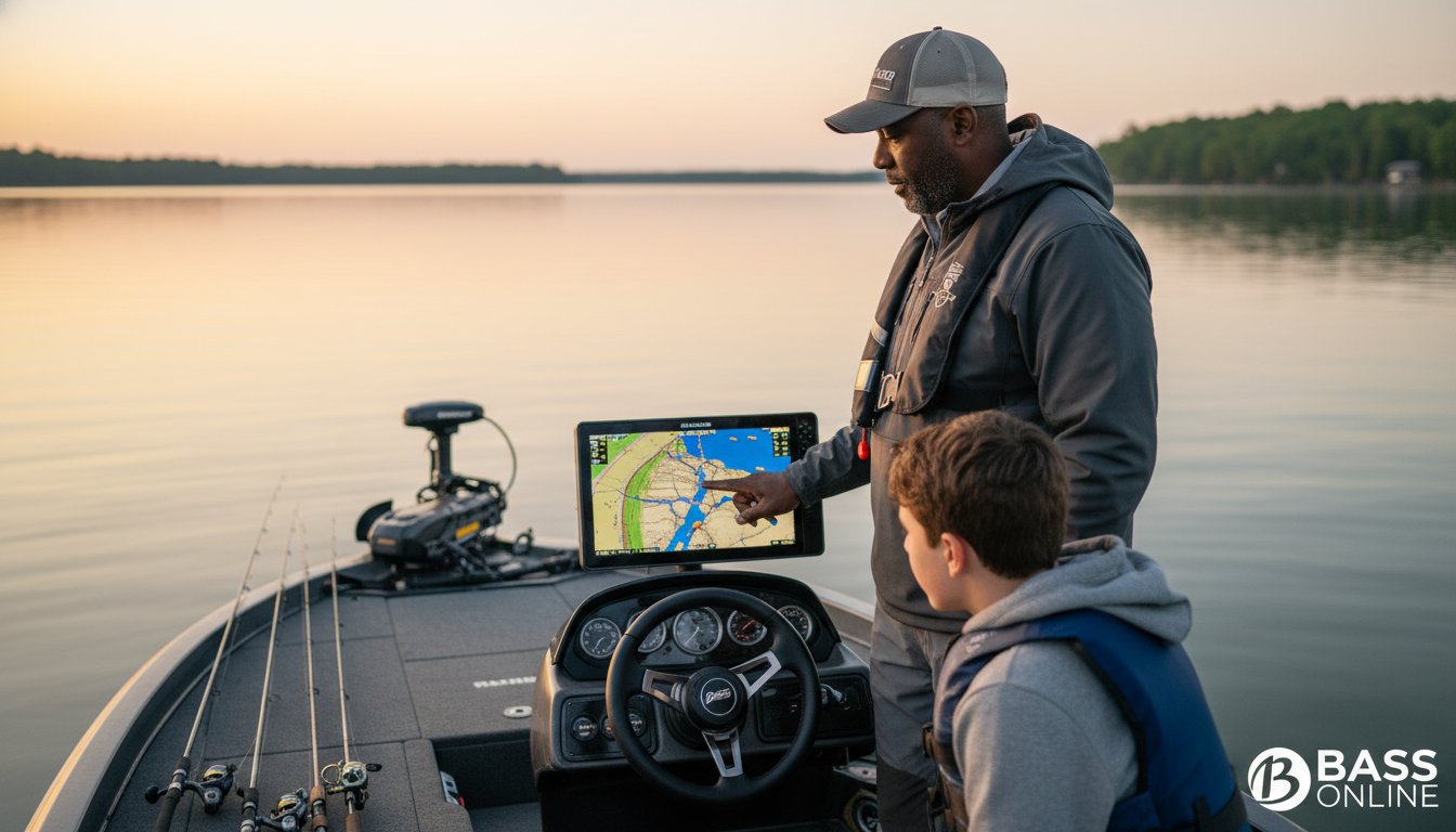

The most expensive sonar unit in the world is just a high-definition video game if you don’t know how to read the bottom. You’ve likely spent hours idling over deep water, staring at colorful arches on your screen, and wondering why you can’t buy a bite. It’s a common struggle for many anglers, but mastering the art of understanding lake structure for bass fishing is the fastest way to stop guessing and start catching. When you know how to interpret the underwater landscape, the lake stops looking like a vast mystery and starts looking like a target rich environment.
I’ve spent years on the water guiding folks through the complexities of underwater topography, and I know that once you see the pattern, you can’t unsee it. I agree that nothing is more frustrating than a slow day on a new lake. I promise this masterclass will help you locate more trophy bass and turn every outing into a success. We’ll dive into identifying high-percentage spots quickly, the specific reasons why bass move to certain areas, and how to use modern technology to find those hidden offshore highways where the giants live.
- Learn the critical difference between permanent structure and seasonal cover so you can stop fishing “empty furniture” and start finding the “house.”
- Master the art of understanding lake structure for bass fishing by pinpointing the exact sweet spots on ledges and secondary points where trophy fish school up.
- Discover how to use creek channels as underwater highways to intercept bass during their massive seasonal migrations from deep water to the shallows.
- Gain the skills to analyze contour maps like a pro, identifying “clumping” lines that signal the steep drops and high-percentage hunting grounds.
- Understand how professional guidance can slash your learning curve and help you translate complex sonar data into a successful day on the water.
Structure vs. Cover: Why Most Anglers Get It Wrong
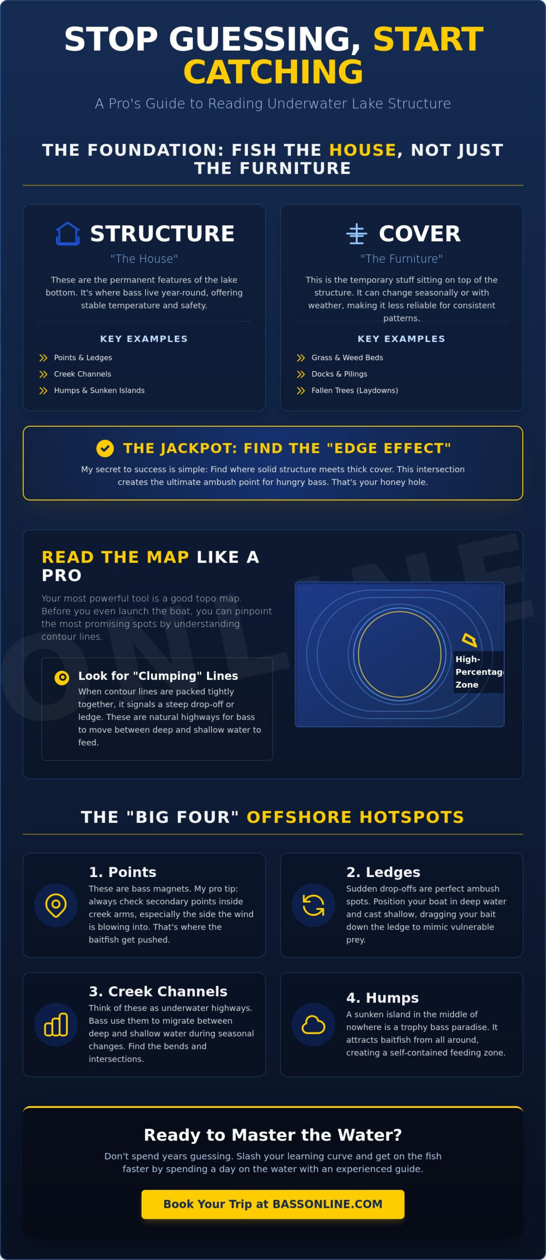
To get consistent results, you have to change how you look at the water. I see too many guys beating the bank and casting at every piece of visible wood they find. That’s fishing for cover, not structure. In my world, structure is the “house” while cover is just the “furniture.” Structure refers to the permanent physical features of the lake bottom, like points, ledges, and creek channels. Cover is the stuff that sits on top of it, like grass, docks, or fallen trees. While cover might hold a fish for a few days, structure is what dictates where the fish live throughout the year.
Mastering the art of understanding lake structure for bass fishing is about biology, not just luck. Bass are cold-blooded creatures that rely on the environment for thermoregulation, which is how they manage their body temperature. Deep structure provides a stable refuge from extreme heat or cold. It also offers a safety net where they can retreat when pressure gets high. When you find the “Edge Effect,” where a solid piece of structure meets a thick patch of cover, you’ve found the jackpot. This combination creates the ultimate ambush point for a hungry predator. If you want to learn more about the history and habits of these fish, checking out resources on Bass fishing can give you a solid foundation.
To better understand this concept, watch this helpful video:
The Topography Factor: Reading the Bottom
Bathymetry is just a fancy word for the study of underwater depth and shapes. It’s the foundation of every trip I lead on different lakes across the country. When you look at a map, you’re looking for contour lines, which represent depth changes. If those lines are “tight” or close together, it means you’ve found a steep drop-off. These areas act as natural highways for bass. Predators love these sudden depth changes because they can move from deep to shallow water in seconds to ambush baitfish without burning much energy.
Why Structure Beats Cover for Consistency
Cover is “here today, gone tomorrow.” A big storm can wash away a laydown, and seasonal changes can kill off an entire grass bed in a week. If you rely solely on cover, you’re constantly hunting for new spots. Structure is different; it’s permanent. A ledge that held fish last year will likely hold fish this year. This reliability is why I focus on finding “hidden gems” on structure rather than just hitting the famous “community holes” that everyone sees on their GPS. Mastering the bottom allows you to build a milk run of spots that produce fish year after year, regardless of what the weeds are doing.
The Big Four: Mastering Primary Structural Elements
If you want to catch fish consistently, you need to master the Big Four. These are the structural pillars that hold fish throughout the changing seasons. While a casual angler might just see a shoreline, a seasoned pro is looking for the skeleton of the lake. A great resource from Bassmaster differentiates between structure and cover, and it is a distinction you must live by. Understanding lake structure for bass fishing starts with identifying where these major physical features intersect to create the perfect ambush zone.
Points and Ledges: The Intersections of the Lake
Primary points get all the tournament pressure, but secondary points are often the real honey holes. These are the smaller points found inside a creek arm. They act as critical staging areas for fish moving toward spawning flats. When the wind picks up, hit the wind-blown side immediately. The wind pushes plankton toward the point, which draws in schools of baitfish and triggers a violent feeding frenzy. Boat positioning is everything here. I usually keep my boat in deep water and cast up onto the ledge, dragging my bait down the drop-off to mimic a dying shad. For some foundational tips on how to place that perfect cast, check out my guide on Bass Fishing 101.
Creek Channels and Humps: Deep Water Secrets
Creek channels are the literal highways of any reservoir. During the dog days of summer or the dead of winter, bass use these deep trenches to navigate and find stable water temperatures. Look for channel swings where the old riverbed cuts close to a steep bank or a point. These sharp turns create vertical walls that act as a magnet for big fish. Submerged humps or islands are my favorite hidden gems because they are invisible to the naked eye. These are high spots that don’t break the surface but offer a shallow plateau surrounded by deep water. If you find a hump where the bottom composition changes from soft mud to hard rock, you’ve found a trophy bass sanctuary. Mastering these elements is the secret to understanding lake structure for bass fishing like a local pro. If you’re ready to see these spots in person and master your electronics, book a trip with us and we will put you right on the action.
The Bass Highway: How Structure Dictates Seasonal Movement
Bass don’t just wander aimlessly through the water. They are creatures of habit that follow specific underwater paths, much like we use interstate highways. If you want to master understanding lake structure for bass fishing, you have to stop thinking of spots as isolated islands and start seeing them as part of a connected system. Throughout the year, bass migrate along these structural lines to meet their biological needs for spawning, feeding, and temperature regulation. They aren’t roaming the open abyss; they are following the road map written on the lake floor.
During the pre-spawn migration, creek channels serve as the primary route from deep winter haunts to shallow flats. Think of the main river channel as the interstate and the creek channels as the off-ramps. Bass will “stage,” or group up, at the intersections where a creek channel swings close to a point or a shallow flat. This is where you can catch the biggest fish of the year as they wait for the water temperature to hit that magic window. Once the spawn is over, they don’t just disappear. They begin a post-spawn retreat, often pausing on secondary points inside the creeks to feed before heading back to the deep ledges for the summer heat.
Spring and Fall: The Transition Periods
Transition periods are all about movement. In the spring and fall, vertical structure is your best friend. A steep bluff wall or a sharp ledge allows a fish to change its depth by 20 feet simply by moving a few yards horizontally. This is crucial when weather fronts move through and water temperatures fluctuate. To find these transition spots on a new map, follow this quick checklist:
- Trace the main creek channel from the mouth to the back of the cove.
- Identify where the channel makes a sharp turn near a shallow flat.
- Look for secondary points that act as “rest stops” along that channel.
- Focus on the first deep water adjacent to a known spawning area.
Summer and Winter: Finding the Stability Zones
When the seasons reach their extremes, bass look for stability. In the summer, the thermocline, which is a distinct layer where water temperature changes rapidly, often dictates how deep a fish can hold. If you fish below the thermocline, you are fishing in “dead” water with no oxygen. Deep-water humps and isolated rock piles become the “oases” of the lake. These spots offer access to cooler water while keeping the fish close to the baitfish schools. For those of you targeting Florida Bass, understanding these warm-water behaviors is the difference between a record day and a total skunking. In the winter, the deepest, most stable holes in the main river channel hold the most consistent schools, as the water temperature there fluctuates the least.
Reading the Map: How to Identify Structure Before You Launch
Success starts at the kitchen table, not at the boat ramp. If you wait until you’re on the water to start looking for fish, you’ve already lost the day. Mastering understanding lake structure for bass fishing requires a pre-trip strategy that turns a massive body of water into a handful of high-percentage targets. I’ve found that breaking the lake down into five simple steps saves gas and keeps your bait in the strike zone longer. You’ve gotta have a plan before the first cast.
- Study the Big Picture: Locate the main river channel and major tributaries. These are the primary travel routes bass use to move throughout the system, as we discussed in the highway concept.
- Look for Contour Clumping: When you see contour lines bunched together, you’ve found a steep drop-off or a vertical wall. These are prime ambush spots.
- Identify Ditches and Depressions: Even a one-foot depth change in a flat can hold a trophy bass. These subtle low spots are often overlooked by other anglers.
- Cross-Reference with Satellite Imagery: Use satellite views to see if that underwater point aligns with a rocky shoreline or a specific type of vegetation.
- Mark Your Waypoints: Drop digital pins on the most promising intersections before you ever leave the dock.
Digital Mapping vs. Traditional Paper Charts
Modern technology has changed the game. Apps like Navionics or C-MAP allow you to use depth shading to highlight specific depth ranges, making it easy to scan a new lake in minutes. This feature helps you quickly visualize the transition zones where bass congregate. However, don’t throw away those old paper charts just yet. Old-school maps often show lost structure like flooded roadbeds or old building foundations that modern digital maps might miss. Combining both gives you an edge over the competition on pressured lakes.
Using Sonar to Confirm Structure
Once you’re on the water, your electronics act as your eyes. While Down Imaging gives you a vertical look at what’s directly beneath the boat, Side Imaging lets you see 100 feet in either direction to find isolated rock piles or hard-bottom transitions. You can tell the difference between a rock pile and a brush pile by the shadow it casts; rocks have sharp, hard shadows, while brush appears softer and more irregular. Side Imaging is the ultimate tool for scanning ledges efficiently. If you want to see exactly how I interpret these screens to find giants, book a guided bass fishing trip with us today.
Shorten the Learning Curve with a Professional Guide
You can spend weeks studying topo maps and watching videos, but there is no substitute for live, on-the-water experience. Mastering the art of understanding lake structure for bass fishing is a sensory skill as much as an intellectual one. I’ve spent thousands of hours on various lakes, and I can tell you that a guide’s job is to translate that theory into a heavy livewell. We don’t just stare at screens. We teach you how to feel the structure through your rod tip and anticipate the next move of a trophy fish.
Local knowledge is the ultimate weapon. A map might show you a hundred ledges, but it won’t tell you which three are “fired up” because of a specific current flow or baitfish migration. A professional guide knows the history of the water. We understand the subtle patterns that take years to decode. By spending a day on the boat with a pro, you gain years of insight in just a few hours. It is the fastest way to turn a frustrating hobby into a consistent success story. At Bass Online, we specialize in providing that shortcut to your personal best.
Why On-the-Water Experience Trumps YouTube Theory
YouTube is great for the basics, but it can’t teach you the nuance of feel. When your lure bumps a piece of structure, do you know if it’s a soft cedar stump or a hard limestone rock? That distinction is often the difference between a bite and a snag. Our Fishing Guides adapt in real-time. If the water level drops six inches or a cold front pushes the baitfish off a ledge, we know exactly which secondary structure the bass will slide to. Don’t just take my word for it. Look at our Fishing Charter Reviews to see how many personal bests have been caught when theory meets professional execution.
Booking Your Next Adventure with Bass Online
We offer a true full-service experience across the country’s most legendary waters. You don’t need to worry about the gear, the boat, or the electronics. We provide everything you need to hunt for giants. Whether you want to master the grass on Lake Okeechobee or the deep ledges of Lake Guntersville, our team is ready to lead the way. We take pride in our rugged, results-driven approach that puts you in the middle of the action from the first cast. Understanding lake structure for bass fishing is much easier when you have a seasoned expert standing right next to you. Stop guessing and start catching. Book your guided bass fishing trip today!
Master the Bottom and Dominate the Water
You now have the blueprint to stop fishing empty water and start targeting the spots that actually hold fish. Remember that structure is the permanent foundation of the lake; it’s the house where trophy bass live year-round. By focusing on those primary points, deep humps, and creek channel highways, you’re no longer just casting at shadows. You are hunting with a purpose. Mastering understanding lake structure for bass fishing takes patience and a sharp eye on your electronics, but the payoff is a lifetime of more consistent, bigger catches. If your goal is to find a permanent property near these productive waters in the western region of Wisconsin, you can read more about the La Crosse area and land options through Coulee Land Company.
At Bass Online, we bring over 25 years of professional guiding experience to every outing. We feature top-rated guides across all major US bass lakes who live for the raw excitement of a successful expedition. Our all-inclusive trips mean we provide the professional gear and the local expertise needed to put you on the fish of a lifetime. Ready to hunt trophy bass on the best structure in the country? Book your trip now! The water is calling. Get out there and put these lessons to work today.
Frequently Asked Questions
What is the difference between structure and cover in bass fishing?
Structure is the physical layout and shape of the lake floor, like points, ledges, and creek channels. Cover refers to things that grow or sit on top of that structure, such as grass, docks, or fallen trees. I tell my clients to think of structure as the house and cover as the furniture. While fish might move between different pieces of furniture, the house itself stays in the same place year after year.
What is the best type of lake structure for catching largemouth bass?
The most productive structure for largemouth is usually a point that intersects with a creek channel. This combination provides a clear travel route and a shallow hunting ground in one spot. I look for areas where the channel swings close to the tip of a point. These sweet spots allow bass to move vertically to feed without traveling long distances, making them highly consistent throughout the season.
How do I find creek channels on a lake map?
You can find creek channels by looking for V or U shaped contour lines that wind through the flats on a topographical map. These lines represent the old river or stream bed that existed before the lake was flooded. Follow these lines from the main river into the coves. They are the primary highways bass use during their seasonal migrations and are essential for anyone understanding lake structure for bass fishing.
Why do bass hold on points during the spring and fall?
Points are natural rest stops for bass because they offer quick access to both shallow and deep water. In the spring, they are the last stop before the spawn. In the fall, they are the first stop as fish move back out to deep wintering holes. They are also prime feeding zones because current often hits them, disorienting baitfish and triggering a violent reaction bite from hungry predators.
Can I find lake structure without expensive sonar electronics?
You don’t need a massive screen to find structure if you pay attention to the shoreline. If you see a rocky bluff on the bank, that vertical structure almost always continues underwater. A long, flat point on land usually extends far into the lake too. Combine these visual cues with a high-quality paper map to identify high-percentage spots before you ever make a cast.
What are secondary points and why are they important?
Secondary points are the smaller points found inside a creek or cove rather than on the main body of the lake. These are essential for understanding lake structure for bass fishing during the pre-spawn months. Bass use these as staging areas to wait for the right water temperature. If the main lake points are empty, move inside the creeks to find these secondary targets where fish group up before spawning.
How does water level affect lake structure and fish positioning?
Water levels dictate how deep or shallow a fish will hold on a piece of structure. When the water rises, bass often move up to the shallowest part of a point or ledge to explore new cover. If the water drops quickly, they’ll retreat to the first deep structural break, like a channel edge or a steep drop-off. They do this to feel secure and avoid being trapped in shallow water.
What is a hump and how do I fish it effectively?
A hump is an isolated high spot on the lake bottom that doesn’t reach the surface. It is essentially an underwater island. To fish it right, I keep my boat in the deeper water surrounding the hump. Cast your lure across the shallowest part and drag it down the slopes. Bass often sit on the down-current side of the slope waiting for a meal to wash over the top.

Article by
Mr Bass
Todd Kersey, widely known as Mr. Bass by Field & Stream, is a professional angler, accomplished author, and dedicated philanthropist with a lifelong passion for bass fishing. Armed with a degree in Outdoor travel, Mr. Bass has expertly combined his knowledge with his practical fishing experience to become one of the most respected names in the bass fishing, his deep understanding of bass habitats, and fish behavior has earned him numerous accolades as a asset of the sport. Serving 8 years as FWC Stakeholder Chairperson. Leading and passing cutting-edge legislation, such as the Black Bass Management plan, and successfully building, passing, and financing the Trophy Catch program. As CEO, he is committed to giving back to the community through his philanthropic efforts. He supports a variety of causes, especially those centered around physical disabilities. Through his advocacy, his mentorship programs inspire anglers to engage in fishing stewardship, helping to raise more than $ 18 million in donations. Mr. Bass continues to inspire anglers and outdoor enthusiasts alike with his commitment to the sport and the world around him.