 Guides Wanted
Lake Chatuge

0 Reviews
Quick Summary
Lake Chatuge is a 6,700-acre TVA mountain reservoir on the Georgia-North Carolina line, known for clear-water bass, hybrid, crappie, catfish, bluegill and walleye fishing near Hiawassee.
Top Fishing Guides on Lake Chatuge
Guides WantedLake Chatuge Reviews
Top Target Species on Lake Chatuge
Spotted Bass
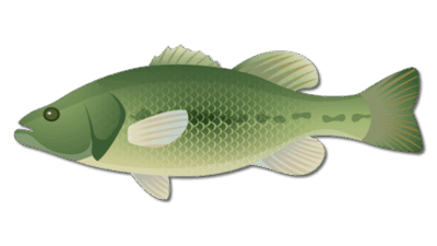
Largemouth Bass

Hybrid Striped Bass
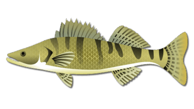
Walleye
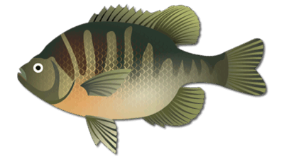
Bluegill
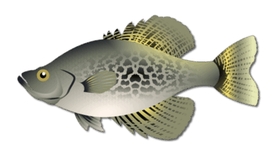
Crappie
Frequently Asked Questions about Lake Chatuge
What fish are in Lake Chatuge?
Lake Chatuge supports spotted or Alabama bass, largemouth bass, hybrid striped bass, bluegill, catfish, crappie, walleye and other species. Georgia DNR currently highlights Alabama bass, largemouth bass, hybrid bass, bluegill, catfish, walleye and carp as important fisheries.
What is the best time to fish Lake Chatuge?
Spring and fall provide comfortable conditions and strong opportunities for several species, but Lake Chatuge can be fished year-round. Summer often favors early, late, nighttime or deeper-water fishing, while winter rewards slower presentations around bait and stable structure.
Do I need a Georgia or North Carolina fishing license at Lake Chatuge?
License and harvest requirements depend on the water you fish because Lake Chatuge crosses the state line. Verify current Georgia and North Carolina rules before the trip rather than assuming one license or limit applies everywhere.
Where should bass anglers start on Lake Chatuge?
Long points, creek-channel intersections, docks, rocky banks and areas holding blueback herring are practical starting places. Use electronics and current wind, water clarity and bait position to choose the productive depth.
Is there a public meeting area on the Georgia side?
The Georgia Mountain Fairgrounds area at 1311 Music Hall Road in Hiawassee is a recognizable Georgia-side meeting location with boat access. Always confirm the exact ramp with your guide before departure.
Why hire a Lake Chatuge fishing guide?
A local guide can help locate seasonal fish, interpret clear-water and open-water patterns, select suitable tackle and navigate changing reservoir conditions. Confirm the target species, launch point, trip length and included equipment before booking.
Lake Chatuge Fishing Guide
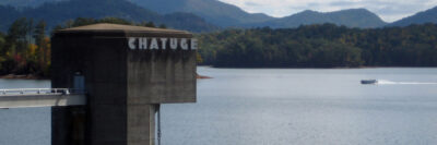
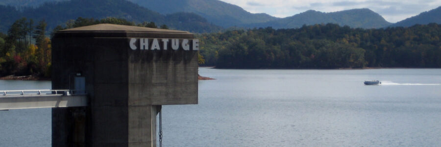
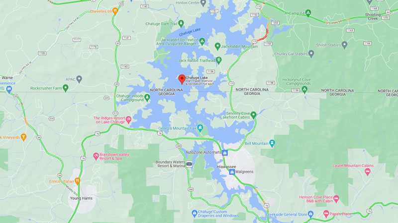
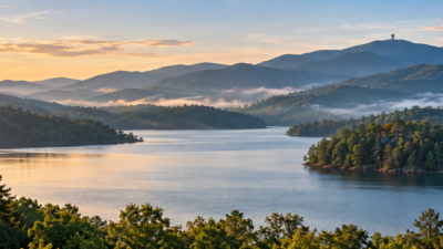
Lake Chatuge fishing combines clear mountain water, long points, steep banks, creek arms and open-water forage on the Georgia-North Carolina line. This TVA reservoir covers about 6,700 acres and has roughly 128 miles of shoreline, according to the TVA Chatuge Reservoir land management plan. The Georgia side is centered around Hiawassee and Young Harris, while the reservoir extends north into Clay County, North Carolina.
For anglers, the main attraction is variety. Spotted bass are the most common black bass, but largemouth bass, hybrid striped bass, bluegill, catfish, crappie and walleye all provide seasonal options. The current Georgia DNR fishing forecast lists Alabama bass, largemouth bass, hybrid bass, bluegill, catfish, walleye and carp among Chatuge’s best bets. Plan around the species, season and part of the reservoir you intend to fish rather than expecting one pattern to work everywhere.
What Makes Lake Chatuge Different
Chatuge is a mountain reservoir with relatively clear water and substantial seasonal water-level changes. Its structure includes long tapering points, bluff banks, submerged roadbeds, creek channels, docks and pockets with brush or woody cover. Clear water often makes natural lure colors, longer casts and careful boat positioning important. Wind, cloud cover and current can reduce visibility and bring fish shallower, while bright, calm conditions commonly favor deeper presentations.
TVA describes Chatuge as a headwater reservoir with no upstream impoundments. The agency manages the reservoir for flood control, power production, recreation and environmental stewardship. Water level and generation conditions can change, so check current TVA information before launching and avoid treating a specific depth from an old report as a permanent rule.
Primary Fish Species
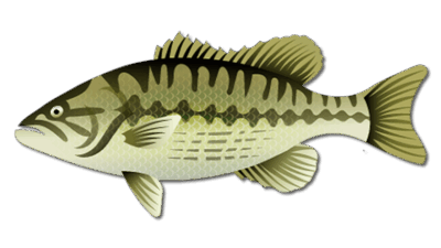
Spotted bass, often identified in Georgia management information as Alabama bass, are a leading target. They frequently relate to points, offshore structure, docks and schools of blueback herring. A compact swimbait, jerkbait, topwater, drop-shot or finesse worm can cover different depths without abandoning the forage profile.
Largemouth bass are more likely around protected pockets, shallow wood, docks and vegetation where available. Hybrid striped bass may roam open water and can be easier to locate by watching for bait, bird activity and surface feeding. Bluegill and crappie use shoreline cover, brush and docks, while catfish offer an option around channels and deeper flats.
Walleye are another established Chatuge fishery. Low-light periods, rocky points, channel edges and suspended forage deserve attention, especially during seasonal transitions. Because species-specific limits can differ across the state line, confirm the rules for the water you will fish before keeping a catch.
Seasonal Lake Chatuge Fishing Patterns
Spring: Warming water moves bass toward secondary points, creek channels, protected pockets and spawning cover. Start outside the pocket and work inward until the active depth becomes clear. Jerkbaits, soft-plastic swimbaits, shaky heads, jigs and finesse worms can all produce. Crappie may move toward brush, docks and protected shoreline cover, while walleye activity can improve during early-season low-light periods.
Summer: Clear water, boat traffic and heat often push fish toward deeper structure or low-light feeding windows. Fish early, late or at night when practical. During the day, scan points, humps, channel edges and suspended bait before casting. Drop-shots, deep-running crankbaits, underspins, spoons and compact swimbaits are useful when fish hold offshore. Keep an open-water rod ready if hybrids or bass begin feeding on the surface.
Fall: Cooling water can pull forage into creek arms and across long points. Moving baits help cover water, but slow down after finding a productive depth or concentration of bait. Topwaters, jerkbaits, swimbaits and finesse presentations can all fit the season. Wind-blown banks and points may concentrate food and make otherwise clear water easier to fish.
Winter: Stable deeper water becomes important. Use electronics to identify bait and fish before spending time on an area. Slow presentations around channel swings, steep points and vertical structure are often more efficient than repeatedly casting shallow water. A warming afternoon can still create a short shallow opportunity, particularly near rock.
Where to Start
Begin with a map and choose a small section instead of trying to cover the entire reservoir. Long points near a creek channel are practical search areas because they allow you to test multiple depths. If bait and fish are suspended, match that depth rather than fishing only the bottom. In protected pockets, inspect docks, brush and the first meaningful drop outside the shallow cover.
- Points and humps: Search with jerkbaits, swimbaits or crankbaits, then follow with a drop-shot or finesse worm.
- Docks and shoreline cover: Use accurate casts with jigs, soft plastics and small moving baits.
- Creek channels: Follow bends and intersections where bass, crappie or walleye can intercept forage.
- Open-water bait: Watch electronics and surface activity for roaming bass and hybrids.
- Wind-blown banks: Use the wind when it concentrates forage, but keep boat control and safety first.
The Georgia DNR forecast is especially valuable because fisheries staff update lake profiles with techniques, access points, fish-attractor information and mapped locations. Use those official resources to narrow the search, then let current water clarity, temperature, wind and bait position determine the final pattern.
Access and Meeting Location
The Georgia Mountain Fairgrounds area at 1311 Music Hall Road in Hiawassee provides a recognizable Georgia-side meeting point and includes a boat ramp. Confirm the exact launch with your captain before the trip because weather, water level, group needs or fishing conditions may make another ramp more practical. Arrive early enough to organize tackle and safety equipment without blocking the launch.
Anglers fishing from shore should focus on legal public-access areas and respect posted boundaries. Bank access is more limited than boat access on parts of this mountain reservoir. A boat expands the available water, but unfamiliar points, changing levels and long open stretches require attention to navigation, weather and fuel.
Licenses, Regulations and Safe Boating
Lake Chatuge crosses the Georgia-North Carolina boundary. Do not assume one license or one state’s limits automatically cover every part of a trip. Review the current Georgia fishing regulations for Georgia waters and the current North Carolina inland fishing regulations before fishing the North Carolina side. Verify species limits, size rules, license requirements and any current advisories on the day of the trip.
Wear a properly fitted life jacket, carry required safety equipment and check weather before leaving the ramp. Mountain winds and thunderstorms can change conditions quickly. Use navigation lights when required, keep a charged communication device aboard and reduce speed in unfamiliar water or near other anglers.
Plan a Guided Lake Chatuge Trip
A local guide can shorten the learning curve on a clear, deep reservoir where fish may move between shoreline cover and open water. Before booking, share your target species, experience level, group size and preferred trip length. Families and newer anglers may benefit from a shorter trip built around steady action, while experienced anglers may prefer a focused bass, hybrid or walleye plan.
See available Lake Chatuge fishing guides and confirm the launch location, included equipment and license needs before arrival. The goal is a plan matched to current conditions, not a promise based on an old fishing report.
Featured Post for Lake Chatuge