 Guides Wanted
Jackson Lake
2 Reviews
Quick Summary
Jackson Lake is a 4,750-acre central Georgia reservoir known for crappie, spotted and largemouth bass, catfish, bream and striped bass. Plan around river arms, creek channels, docks, seasonal forage movement and current Georgia regulations.
Top Fishing Guides on Jackson Lake
Guides WantedJackson Lake Reviews
Top Target Species on Jackson Lake
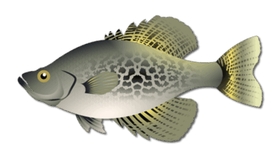
Crappie
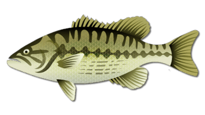
Spotted Bass
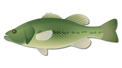
Largemouth Bass
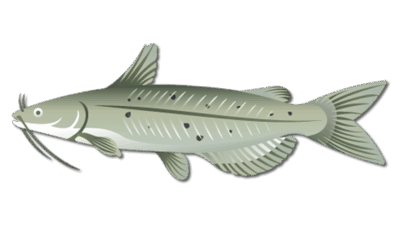
Channel Catfish
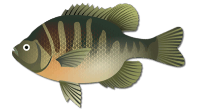
Bluegill
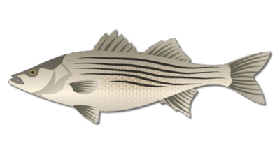
Striped Bass
Frequently Asked Questions about Jackson Lake
How large is Jackson Lake in Georgia and where is it?
Georgia Power lists Jackson Lake at approximately 4,750 acres with about 135 miles of shoreline. The reservoir lies in central Georgia at the confluence of the South, Yellow and Alcovy rivers, with Tussahaw Creek also entering the lake.
What fish species are in Jackson Lake, Georgia?
Georgia DNR identifies crappie, spotted bass, largemouth bass, catfish, bream and striped bass as the lake’s principal fishing opportunities. The most productive target and depth vary with water temperature, forage, rainfall and generation.
When is the best time to fish Jackson Lake?
Spring and fall are strong all-around periods for bass and crappie. Summer can be productive early, late and at night, while winter usually rewards slower presentations around deeper structure. Daily weather and water conditions can matter more than the calendar.
Do I need a Georgia fishing license at Jackson Lake?
Most anglers must carry the appropriate Georgia fishing license. License requirements, seasons, methods, size limits and daily limits can change, so check the current Georgia DNR regulations before fishing.
Where can I launch a boat on Jackson Lake?
Georgia Power reports four recreation facilities providing public access to Lake Jackson and the Ocmulgee River below Lloyd Shoals Dam. Confirm current ramp hours, fees, water level and operating conditions with the facility before traveling.
Are there alligators in Jackson Lake, Georgia?
Jackson Lake is near Georgia’s alligator fall line. Georgia DNR says alligators typically occur along and south of that line and can occasionally be seen farther north. Never approach or feed one, keep pets and children away from the water’s edge, and follow GatorWise safety guidance.
Fishing Jackson Lake
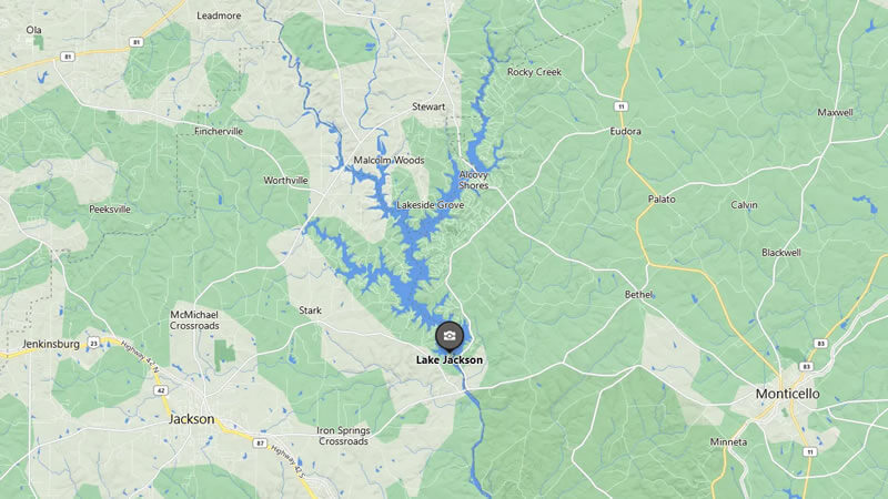
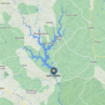
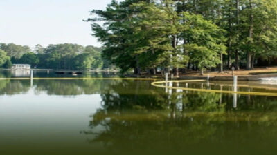
Jackson Lake is a 4,750-acre reservoir in central Georgia, roughly between Atlanta and Macon. The lake sits at the confluence of the South, Yellow and Alcovy rivers, with Tussahaw Creek also feeding the system. Georgia Power lists about 135 miles of shoreline, giving anglers a mix of river arms, creek channels, points, coves, docks and deeper main-lake water to explore.
Georgia Department of Natural Resources fisheries biologists identify crappie, spotted bass, largemouth bass, catfish, bream and striped bass as Jackson Lake’s principal fishing opportunities. Conditions change with water temperature, rainfall, generation and seasonal fish movement, so use the patterns below as a trip-planning framework and check current reports before launching.
Jackson Lake Fishing at a Glance
- Surface area: approximately 4,750 acres
- Shoreline: approximately 135 miles
- Primary waters: South River, Yellow River, Alcovy River and Tussahaw Creek
- Outflow: Ocmulgee River below Lloyd Shoals Dam
- Core species: crappie, spotted bass, largemouth bass, catfish, bream and striped bass
- Nearest primary city: Macon, Georgia
Georgia Power completed the Lloyd Shoals project in the early twentieth century, making Jackson one of Georgia’s older major reservoirs. Its developed shoreline and numerous tributary arms create a fishery where anglers can move between man-made cover, natural channel features and open-water forage patterns during the same trip.
Bass Fishing on Jackson Lake
Jackson Lake supports both spotted bass and largemouth bass. Spotted bass often relate to rocky points, seawalls, channel swings, bridge areas and deeper structure, while largemouth bass are more likely to use protected pockets, wood, shallow cover and the backs of creek arms when conditions are favorable. Docks can hold either species and provide repeatable targets throughout much of the year.
Moving baits help cover water when bass are active. Crankbaits, spinnerbaits, jerkbaits and topwater lures can be effective around points, seawalls and wind-blown banks. When the bite slows, soft plastics, jigs and finesse presentations let anglers work dock posts, brush, rock transitions and deeper drops more deliberately. Boat traffic, water clarity and generation can shift the productive depth from one day to the next.
Crappie, Catfish and Striped Bass
Crappie use creek channels, bridge pilings, submerged brush and dock structure. Spring brings fish toward shallower spawning areas, while summer and winter commonly concentrate them around deeper cover. Small jigs and minnows are standard choices, but exact depth should be adjusted to current water temperature and forage location.
Channel and other catfish use river channels, creek mouths, flats next to deeper water and the lower-lake area. Cut bait, live bait and prepared baits can all produce. During warm months, early morning, evening and night sessions may offer more comfortable conditions, but navigation lights and other boating-safety requirements still apply.
Striped bass roam with baitfish and can change location quickly. Cooler periods often make them more accessible in creek arms and open-water feeding areas, while summer fish may hold deeper where temperature and dissolved oxygen are suitable. Watch for bird activity, surface feeding and bait schools on electronics rather than relying on one fixed spot.
Where to Fish Jackson Lake
Jackson Lake rewards anglers who use its river-and-creek layout to narrow the search. Productive zones can include:
- Alcovy, Yellow and South river arms: channel edges, points and current-influenced structure
- Tussahaw Creek: creek-channel transitions, pockets and seasonal bait movement
- Main-lake and secondary points: natural travel routes between shallow and deep water
- Docks and seawalls: shade, vertical cover and ambush points
- Brush, bridge pilings and fish attractors: cover for crappie, bass and bream
- Lower-lake structure near Lloyd Shoals Dam: deeper water and open-water opportunities
Never assume a marked or previously productive location is safe or active. Reservoir levels, floating debris, underwater obstructions and private-property boundaries can change. Approach unfamiliar water slowly and use current charts, local notices and on-water observations.
Best Times to Fish Jackson Lake
Spring
March through May is a strong all-around window. Bass move toward spawning areas and feeding flats, crappie use shallow cover and tributary areas, and warming water increases activity. Cold fronts can temporarily push fish deeper, so keep both shallow and mid-depth patterns available.
Summer
Early mornings, evenings and overcast periods usually offer the most comfortable conditions. Bass may feed shallow at first light before moving toward shade, current or deeper structure. Crappie commonly relate to deeper brush, while catfish remain a dependable warm-water target.
Fall
Cooling water can move forage into creek arms and trigger schooling activity. Topwater lures, jerkbaits, crankbaits and soft plastics can cover the changing depth range. Crappie and striped bass may also become easier to locate as water temperatures decline.
Winter
Winter fishing is often slower and more methodical. Concentrate on channel swings, deeper points, brush and areas holding bait. Stable weather can be more important than the calendar, and a slow presentation may outperform a fast search bait.
Boat Access and Trip Planning
Georgia Power reports four recreation facilities that provide public access to Lake Jackson and the Ocmulgee River below the dam. Access hours, launch fees and ramp conditions can change, so confirm the current status of the facility you plan to use before leaving home. The existing meeting reference for this page is 278 Marina Circle, Jackson, Georgia; verify the final meeting location when scheduling a trip.
Jackson Lake is about 35 miles north-northwest of Macon and roughly 40 miles southeast of Atlanta. Anglers can explore related trip-planning information for Macon and Atlanta. To review current trip availability, use the Jackson Lake fishing guide listings.
Fishing Regulations and Water Safety
Fishing licenses, seasons, methods, size limits and daily limits can change. Review the current Georgia hunting and fishing regulations before every trip rather than relying on an older summary. Georgia DNR’s official fishing forecasts also provide biologist-based species, access and seasonal information.
Jackson Lake is close to Georgia’s alligator fall line. Georgia DNR advises people using waterways in the species’ range to keep their distance, never feed alligators, dispose of fish scraps properly, supervise children and pets near the water, and avoid swimming in dense vegetation or after dark. Treat any wildlife encounter cautiously and follow posted guidance.
Wear a properly fitted life jacket, monitor weather and generation conditions, carry required navigation equipment and use extra caution around current, docks, submerged structure and the dam area. A safe plan leaves room to adjust when wind, storms, water level or visibility changes.
Featured Post for Jackson Lake