
Before your trip: Navigation conditions and lock schedules change. The 2026 status notes below reflect a point-in-time report, not a guarantee of current access; verify the linked FWC and SFWMD notices before launching.
Lake Okeechobee is too large and too changeable for one “magic spot” to stay best every day. The strongest fishing areas are usually tied to vegetation, wind, water level, access, and seasonal bass movement. This guide highlights 12 productive Lake Okeechobee fishing areas and explains what to look for when you get there. For a complete fishery overview, start with our Lake Okeechobee fishing guide.
Current 2026 navigation note: Lake Okeechobee remains unusually shallow. The Florida Fish and Wildlife Conservation Commission warns boaters about rock and shallow-water hazards, and the South Florida Water Management District currently has several north-shore locks closed or operating on restricted schedules. Before launching, check the FWC Lake Okeechobee forecast and SFWMD navigation notices.
1. Clewiston and the South End
Clewiston is one of the best-known starting points on Lake Okeechobee because it gives anglers access to the south and southwest portions of the lake, the rim canal, and broad fields of emergent and submerged vegetation. Rather than thinking of Clewiston as one single spot, use it as a launch point for finding the best combination of clean water, healthy grass and bait on that day.
- Best pattern: Work outside grass lines, reed and cattail edges, hydrilla or eelgrass where present, and nearby cuts that give bass quick access to deeper water.
- Seasonal edge: Late fall through spring can bring prespawn and spawning bass shallower. During warmer periods, shade, current, deeper edges and oxygen-rich vegetation become more important.
- Field lesson: Productive water can reload. Older Bass Online trips repeatedly showed that leaving a pressured or wind-blown area and returning later sometimes produced a second feeding window.
Clewiston also provides one of the most practical starting points for visitors who want help navigating the lake. If you are new to Okeechobee, especially during low-water periods, consider going with a Lake Okeechobee fishing charter rather than learning shallow routes by trial and error.
2. Harney Pond Canal and the Lakeport Side
Harney Pond Canal on the west side is an established Lake Okeechobee-connected waterway. FWC specifically includes Harney Pond Canal (C-41) within its Lake Okeechobee regulation boundary, which makes it a much stronger geographic reference than treating “Harney Pond” as a vague hotspot. The canal, nearby marsh, outside grass and Lakeport-side water can all be useful depending on stage and vegetation.
- Where to look: Canal mouths, vegetation transitions, outside grass lines and places where moving water meets cover.
- Why it matters: The canal gives fish access between deeper channel water and the shallow lake marsh.
- Low-water caution: The S-131 Lakeport lock is currently among the north-shore locks listed as closed, so verify access before planning a route through the structure.
For a more detailed history of this part of the lake, see our Harney Pond fishing guide and report.
3. Belle Glade and the Southeast End
Belle Glade provides access to the southeast side of Lake Okeechobee, where anglers can work broad marsh areas, rim-canal water and vegetation transitions. The strongest pattern is usually not “fish deep because it is hot” or “fish shallow because it is winter.” Instead, look for the best habitat available under the current water level: healthy emergent grass, submerged vegetation, openings, points and mixed-grass edges.
- Bass: Shiners can be effective, but artificial-lure anglers should also work moving baits, flipping presentations and topwater around clean vegetation.
- Crappie: The south end has also produced strong black crappie catches during cool-season periods.
- Heat-of-day adjustment: When shallow cover becomes less productive, nearby canal water, shade and deeper vegetation edges can give fish another comfort zone.
Historic Bass Online southeast-side reports repeatedly emphasized transition edges where bulrush, eelgrass, knotgrass or other vegetation types meet. That is the durable lesson: fish the change in habitat, not just the name on a map.
4. Fisheating Creek
This location should be called Fisheating Creek, not “Fisheating Bay.” FWC formally includes Fisheating Creek to U.S. 27 within the Lake Okeechobee special-regulation boundary. The creek enters the west side of the lake and creates a different fishing environment than the open marsh: moving water, channel edges, woody cover and transition zones where creek habitat meets lake vegetation.
- Best approach: Focus on current seams, channel bends, vegetation near the creek mouth and places where bait collects.
- After rain: Water color and flow can change rapidly, so be willing to move until you find cleaner or more stable water.
- Navigation: Creek access and depth can vary significantly with water level; confirm current conditions before running unfamiliar water.
5. Rim Canal
The Rim Canal circles much of Lake Okeechobee and can be especially important when wind, low water or changing marsh conditions make open-lake fishing difficult. It is also a travel route, so anglers should separate “canal access” from “the best bass-holding feature.” Fish relate to intersections, culverts, inflows, bridge or structure areas, vegetation, shade and places where the canal connects with the marsh.
- Useful presentations: Jigs, Texas rigs, spinnerbaits, crankbaits and live shiners can all work depending on depth and water clarity.
- Key clue: Look for water movement and bait rather than fishing long stretches of featureless canal.
- Safety: Current lock operations can change which stretches are practical to reach. Check SFWMD before the trip.
6. Moonshine Bay
Moonshine Bay is one of the recognizable named areas in the Lake Okeechobee marsh and already shows search demand of its own. Its value comes from the same ingredients that make much of Okeechobee productive: large vegetation complexes, protected water, travel lanes and edges that can concentrate bass.
- Wind is important: A protected bay may fish very differently from an exposed outside edge on the same day.
- Water clarity: Look for cleaner water and active bait, especially after strong wind has muddied nearby areas.
- Boat positioning: Low water can make seemingly open marsh surprisingly shallow. Ease into unfamiliar water rather than cutting across vegetation blindly.
Moonshine Bay is better treated as a zone to pattern than a single waypoint. Start with visible or mapped habitat changes, then let wind direction, water color and fish activity narrow the search.
7. Bird Island Area
The Bird Island area is another recognizable Lake Okeechobee reference point, but anglers should avoid treating the name itself as a guarantee of fish. Use it as a geographic starting point and then identify the day’s best habitat around it. Emergent vegetation, nearby submerged grass, openings and edges can all produce when bait and water quality line up.
- Fish quietly: In shallow water, reduce unnecessary trolling-motor noise and repeated passes through the same cover.
- Look outward as well as inward: Bass may hold on the outside edge of a vegetation field even when the interior looks more attractive.
- Respect wildlife: Give nesting and resting birds room and avoid damaging emergent vegetation.
8. South Bay
South Bay on the southern rim gives anglers another access point to Lake Okeechobee’s expansive south-end marsh. The productive “spots” here are typically habitat features: cuts, outside vegetation lines, submerged grass, points and openings where bass can feed and move.
- Use electronics selectively: Mapping and sonar are useful for channels, depth changes and navigation, but visual clues such as water color, birds, bait and healthy vegetation matter just as much in the shallow marsh.
- Follow the wind: Moderate wind can push bait toward productive edges; excessive wind can dirty shallow water and make another side of the area more attractive.
9. Shoal and Outside-Grass Areas
Historic north-end Bass Online field reports repeatedly referenced “the Shoal,” Kings Bar, Third Point and nearby outside weed lines. Instead of presenting Shoal Run as a permanently hot waypoint, the useful pattern is the relationship between shoal water, submerged grass and outside vegetation.
- Historic pattern: Submerged vegetation in roughly 3 to 4 feet of water produced fish in multiple guide reports when water levels supported that depth.
- Presentations: Wild shiners and moving artificials such as swimbaits both produced along those outside edges.
- Modern application: Water levels and vegetation have changed since those reports. Use the old observations to understand habitat, then confirm today’s grass and depth before fishing.
10. Pelican Bay and Protected Marsh
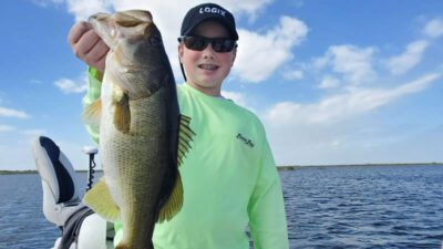
Pelican Bay is best approached as a protected-marsh fishing area where wind direction and vegetation health can create short-lived advantages. Calm mornings can make it easier to see isolated grass clumps, holes and bait movement, while stronger afternoon wind may shift the better bite toward more protected edges.
- Start shallow, then expand: Check productive-looking grass first, but do not stay married to one depth if the activity is missing.
- Conservation: Handle larger bass carefully and release them quickly when practicing catch-and-release.
11. Pickerel Cove and Vegetation Transitions
Pickerel Cove is another named marsh area where precision matters more than the label on the map. Look for transitions between vegetation types, small drains, open pockets and edges that give bass both cover and a feeding lane.
- Finesse when needed: Lighter or slower presentations can help when fish are pressured or conditions are calm.
- Power fishing when cover allows: Heavier tackle, flipping presentations and weedless moving baits make more sense when fish bury in dense vegetation.
The most transferable Lake Okeechobee lesson is that grass is not all equal. A short stretch with better water, bait and two types of cover meeting can outperform acres of similar-looking vegetation.
12. Taylor Creek and the North End
Taylor Creek is a major north-end waterway connected with Lake Okeechobee and is specifically included by FWC within the lake’s regulation boundary. It offers canal habitat, access to north-end marsh and a useful reference point for anglers fishing around Okeechobee City.
- Current access notice: SFWMD reports the S-193 Taylor Creek boat lock has reopened on weekends from 5:30 a.m. to 9:00 p.m. but remains closed on weekdays until further notice.
- Fishing pattern: Work vegetation edges, channel transitions and places where cleaner water or bait concentrates.
- North-end history: Older guide reports also identify Kings Bar, Third Point hydrilla, cattail edges and Kissimmee grass as productive habitat zones when conditions line up.
How to Choose the Best Spot Today
The best Lake Okeechobee fishing spot changes with the conditions. Instead of choosing one name from this list and staying there all day, use a simple decision process:
- Check water level and access first. Low water can make a normally easy route unsafe or inaccessible.
- Find the healthiest vegetation you can reach safely. FWC’s current forecast specifically points anglers toward eelgrass and the outer edge of emergent vegetation as fall bass habitat.
- Compare water color. Cleaner water beside healthy grass often deserves more time than muddy water with no bait.
- Let wind help, not hurt. Moderate wind can position bait; extreme wind can destroy visibility and boat control in shallow marsh.
- Move when the clues disappear. If there is no bait, no clean water and no bites, the name of the spot will not save the pattern.
Seasonal Lake Okeechobee Fishing Patterns
Fall: As temperatures ease, prespawn bass begin building toward the late-winter and spring spawning period. FWC’s September 2026 update notes improving submerged and emergent vegetation and specifically highlights eelgrass along outer emergent-vegetation edges. Topwater action can improve as bass feed more aggressively.
Winter into early spring: This is one of the most anticipated periods for trophy largemouth bass. Shallow cover, spawning areas and protected vegetation become increasingly important, but cold fronts can reposition fish quickly.
Late spring and summer: Watch water temperature, oxygen, shade and wind. Early and late periods can be productive shallow, while deeper canal water, moving water and healthy vegetation can become more important as the day heats up.
Plan the Trip Around Conditions, Not Just Coordinates
Lake Okeechobee rewards anglers who read the lake. Clewiston, Harney Pond, Belle Glade, Fisheating Creek, Moonshine Bay, Bird Island, South Bay, Taylor Creek and the other areas above are useful starting points, but the actual “hotspot” is the best combination of safe access, healthy cover, bait, clean water and fish activity on the day you arrive.
If you want to shorten that learning curve, compare current trip options on our Lake Okeechobee fishing charters page or explore the broader Lake Okeechobee guide. Before launching, always recheck FWC and SFWMD updates because water levels, vegetation and lock operations can change faster than an evergreen fishing article.