 Limited Spots


Apalachicola River (Jackson, Gadsden, Calhoun, Gulf, Liberty, and Franklin counties): The Apalachicola River runs from Lake Seminole on the Florida-Georgia border at Chattahoochee. One hundred six miles south through the Panhandle to the Gulf of Mexico, at the town of Apalachicola. Regarding the volume of water discharged, it is the largest river in Florida. The Apalachicola River offers many good fishing areas; the best are in the upper river.
This is influenced by discharge from Lake Seminole and the lower river, which is influenced by Apalachicola Bay and the Gulf of Mexico. Bag and size limits follow those for Northwest Florida, which includes a 12-inch minimum size limit for largemouth bass (bag limit of five) and an 18-inch minimum size limit for striped bass (bag limit of three).
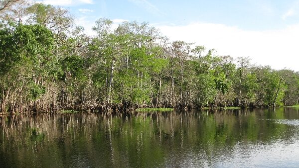
The lower Apalachicola River consists of the main channel and its distributaries, which form the delta: the St. Marks River, Little St. Marks River, and East River. Shoreline access is available only from the public docks on the waterfront in Apalachicola and at the City Dock (Ten-foot Hole) under the Hwy—98 Bridge. Public boating access includes the City Dock, Gardner Landing on the East River, Cash Creek off of Hwy 65, and Magnolia Bluff on the east end of the Hwy 98 Bridge in East Point.
Private launching facilities can be found at several marinas in Apalachicola, East Point, Howard’s Creek off the Brothers River, and Searcy Creek (Intracoastal Waterway) in White City. FWC and the U.S. Fish and Wildlife Service stock striped bass and sunshine bass in the lower and Escambia rivers annually.
Striped bass and sunshine bass fishing in the lower Apalachicola River and the Intracoastal Waterway should improve during the fall. Many of these fish should have remained in the lower river through the past summer and should provide excellent light-tackle or fly rod action through the fall. Larger fish that have been aestivating in cool-water refuges in other parts of the system during the summer months will begin foraging throughout the lower river as water temperatures decline in late October and early November.
Best bets will be bottom fishing with shrimp, live or fresh, near the mouths of the Apalachicola, St. Marks, Little St. Marks, and East rivers, and along the Gulf County Canal and Intracoastal Waterway near Port St. Joe and White City. Larger striped bass may be more readily caught with bucktail jigs or crankbaits near bridge pilings and along deep channels and drop-offs.
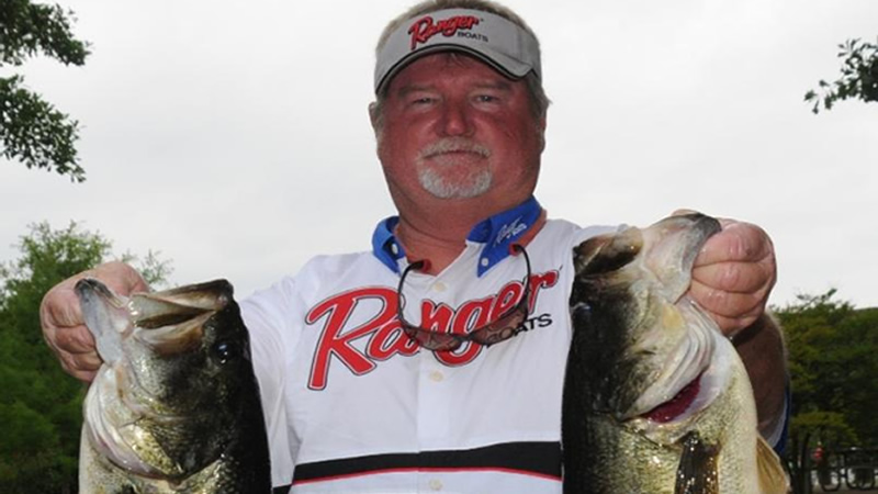
For best results, fish the outgoing tides at the river mouths or the slack tides near bridge pilings. The bag limit for stripers, hybrids, and white bass is 20 fish per day, aggregate, but only three may be striped bass and must be a minimum of 18 inches in total length. Fall is usually a time for good largemouth bass fishing in the lower river. Dipping live shrimp along the steeper, grass-lined banks of St. Marks and East rivers and the smaller sloughs, such as Montgomery Slough and Saltwater Creek, is one of the more popular methods. Spinnerbaits fished along the banks and weed lines of the larger channels and in Lake Wimico are also productive.
As water temperatures drop, speckled trout and redfish will also move into the lower reaches of the Apalachicola and the distributaries. Bucktails, spoons, crankbaits, and live or dead shrimp should all be productive. Flathead catfish fishing is excellent; use live bream or shad in deep-water structures during daylight hours, and in adjacent shallow sand bars at night. Channel catfish should also be biting. Use stink bait or anything smelly, and you should do well.
The upper Apalachicola River has good shore access from Jim Woodruff Dam to Race Shoal (0.9 miles) on the east bank. And from the dam to Hwy. 90 (0.6 miles) on the west bank. Access above Hwy 90 is on the Corps of Engineers (COE) property and includes a fishing catwalk adjacent to the powerhouse at the dam. Boat landings are also located at Chattahoochee, Sneads, Aspalaga (Navigation Mile 98.9), and Ocheesee (NM93.9).
Expect water levels to remain low through October and November. Striped bass and sunshine bass fishing in the tailrace of Jim Woodruff Dam and the upper Apalachicola River will improve as water temperatures decline around the end of October or the beginning of November. During early morning and evening hours, stripers and hybrids will school near the surface and should be readily taken on topwater plugs and crankbaits. During the day, bottom fishing with live shad, shiners, or small eels will likely be more productive. The bag limit for stripers, hybrids, and white bass is 20 fish per day, aggregate. But only three may be striped bass that must be 18 inches long. There is no size limit for hybrids or white bass.
Contact Riverview Bait & Tackle (850-663-2462) in Chattahoochee for more information. Bay City Marina (850-653-9294), or Scipio Creek Marina (850-653-8030) in Apalachicola, and Fisherman’s Choice (850-670-8808) in Eastpoint.
The Apalachicola River is a river, approximately 112 mi (180 km) long, in the state of Florida. The river’s large watershed, known as the ACF River Basin, drains approximately 19,500 square miles into the Gulf of Mexico.
The Apalachicola River is a 112-mile river in Florida. The River is considered a river with a large watershed, the ACF River Basin. Drains an area of approximately 19,500 square miles into the Gulf of Mexico.
Some of the remaining vital areas of natural habitat along the river include Apalachicola National Forest, Torreya State Park, and The Nature Conservancy. Let’s not forget the Apalachicola Bluffs, the Ravines Preserve, Tates Hell State Forest, the Apalachicola River Wildlife and Environmental Area, and the Apalachicola River Water Management Area.
The Appalachian, also known as the Apalachicola River, is a river approximately 112 miles long in the state of Florida. The river‘s large watershed, known as the ACF River Basin, drains an area of roughly 19,500 square miles into the Gulf of Mexico.
If heading north, the Apalachicola will narrow to the Lake Seminole lock, where, once on the other side, you can fish all of Lake Seminole, which lands you in the state of Georgia.